Geographical BackgroundGlobal Water Supply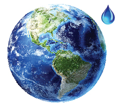 The global water supply seems plentiful because it is spread over two thirds of the Earth's surface. But its total volume is relatively small — equivalent to the drop shown here. The global water supply seems plentiful because it is spread over two thirds of the Earth's surface. But its total volume is relatively small — equivalent to the drop shown here. The world's total water supply is estimated to be approximately 1,386,000,000 cubic kilometres, over 96% of which is saltwater. The rest is mostly freshwater, but two-thirds of that is in ice caps, glaciers, and permanent snow, while close to one-third lies underground. Ground ice, permafrost and lakes constitute much of what remains, and still more is held by atmosphere, wetlands and soils.  In the image at right, the largest drop represents all the water on Earth in the oceans, lakes and rivers, the atmosphere, the ice and snow, as well as all of the groundwater, and the water within living things. The middle drop represents liquid freshwater in groundwater, wetlands, rivers, and lakes. Most of this water is in the ground. The smallest drop represents all the freshwater in lakes and rivers. Most of the water that sustains all terrestrial plants and animals comes from these surface-water sources.37 In the image at right, the largest drop represents all the water on Earth in the oceans, lakes and rivers, the atmosphere, the ice and snow, as well as all of the groundwater, and the water within living things. The middle drop represents liquid freshwater in groundwater, wetlands, rivers, and lakes. Most of this water is in the ground. The smallest drop represents all the freshwater in lakes and rivers. Most of the water that sustains all terrestrial plants and animals comes from these surface-water sources.37
RiversRivers provide water for drinking, hydroelectricity, agriculture, industry, and travel routes for exploration, commerce and recreation. They are also vitally important to nature. They provide drainage channels for precipitation, nourish and protect plants and animals, deposit sediments, disperse organisms, and create beautiful scenery. They also play an integral role in The Hydrologic Cycle. Atmospheric water falls to earth as precipitation, percolates into the ground, is stored as ice or snow, or is taken up into the atmosphere by evaporation and transpiration to begin the cycle again. |
The Hydrological Cycle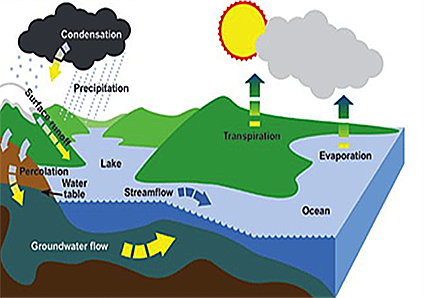 Source: Environment Canada Geology of the watershedThe Mighty Peace watershed was once a much different place. A hundred million years ago, the climate was warmer. Dinosaurs, ammonites, clams, sea stars and primitive plants such as conifers, cycads and ferns were the first inhabitants. An inland sea covered a huge area now called the Western Canada Sedimentary Basin. These waters provided habitat for marine animals and deposited the sediments that became the bedrock and the fossil fuels that now support the oil, gas and coal industries.
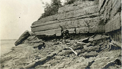
For the last 3 million years, Ice Ages have regularly scoured the landscape, leaving behind the glacial till of sands, clays and gravels that now cover much of the region. The Peace River and its tributaries emerged in the wake of the most recent Ice Age, 12,000 years ago. |
| © 2015 Mighty Peace Watershed Alliance | CONTACT THE ALLIANCE |
NEXT PAGE: Background on Wetlands |